

.webp)







Surveying & Geomatics
Surveying & Geomatics that Anchors the Design to the Real World
Every Project Starts with a Measurement
Every engineering, architectural, and development project starts with a measurement of the real world, where the property boundaries are, where the existing structures sit, where the grade rises and falls, where the services enter the site, and how all of those relate to what the project intends to build. That measurement is the foundation every subsequent drawing depends on. Survey errors propagate into grading, servicing, structural layout, and municipal approval, and the cost of catching them late is orders of magnitude greater than the cost of getting it right up front.
DWE's Surveying & Geomatics practice is led by licensed land surveyors working in the same studio as our civil, structural, and building-engineering teams. That integration matters: the engineers who will consume the survey data are next to the surveyors producing it, which means the survey scope reflects what the engineers actually need, not a generic checklist that omits the specific data point that matters most for this project.
Legal Surveying and Real Property Reports
Land surveying is a regulated profession in every Canadian province, and the legal surveying work is. Real Property Reports, Plot Plans, Lot Grading Certificates, Subdivision plans, and Condominium plans can only be signed by a licensed Land Surveyor of the relevant provincial association. We deliver these products in accordance with the applicable regulatory regime in each jurisdiction in which we operate, with the precision and documentation discipline that professional regulators expect.
Construction, As-Built, and Engineering Surveys
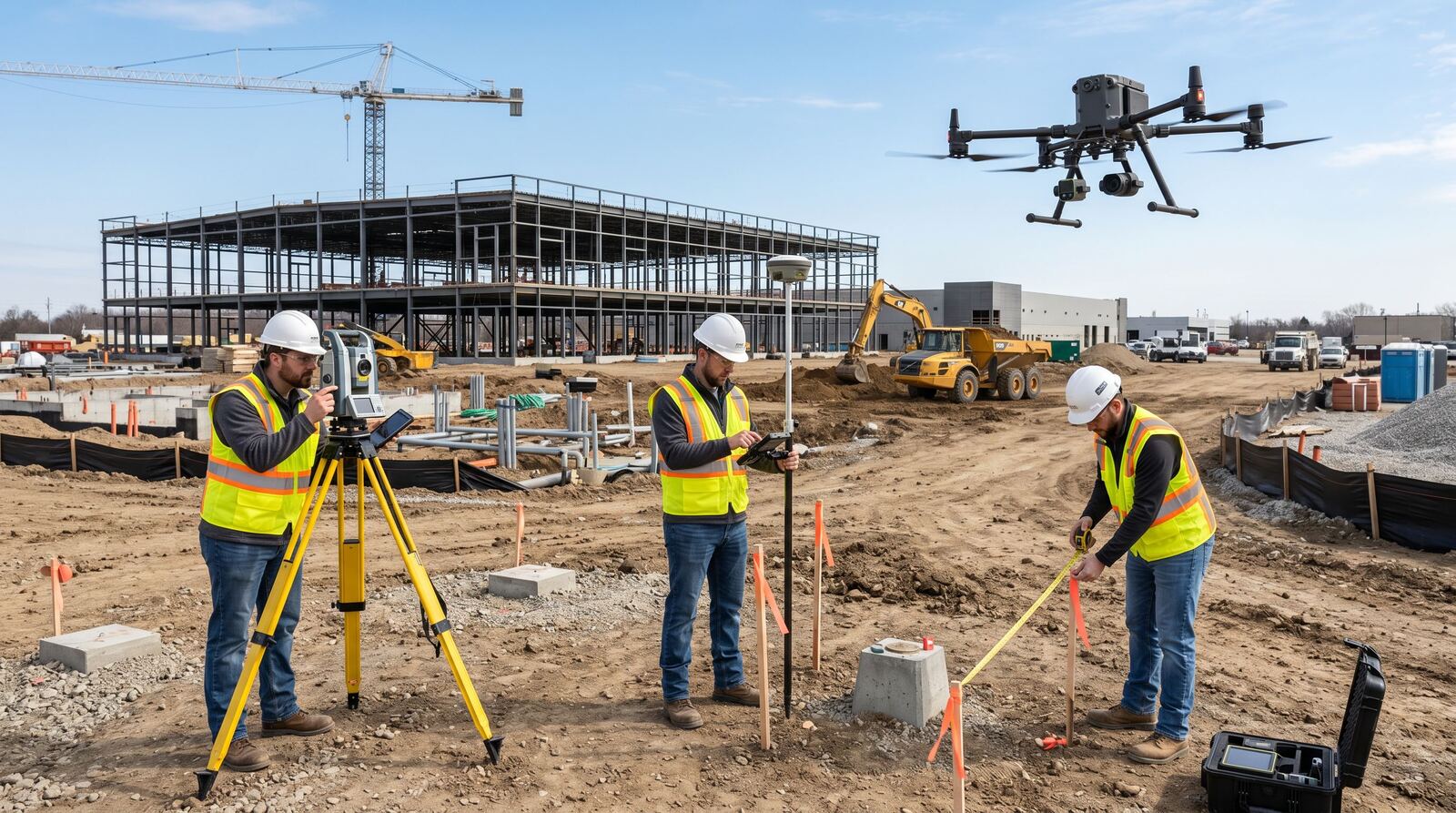
Construction surveying connects the design drawings to the physical site. Excavation stakeouts, building-envelope layout, utility alignment, curb and grade lines, and final as-built verification are the survey products that keep a construction schedule moving and a building on the right coordinates. Topographic surveys, meanwhile, produce the 3D base model that every civil, landscape, and structural design depends on. Our team runs both sides of that work. When an as-built is needed at the end of the project to close out the municipal file, it's produced by the same team that did the original topographic. Hence, the comparison is clean, and the deliverable is consistent.
Geomatics for Planning and Development
Beyond legal and construction surveying, modern land-development practice consumes geomatics data in more forms than ever, aerial orthophotography, LiDAR-derived terrain models, GIS-integrated service records, and drone-based progress documentation. We incorporate these data sources alongside conventional survey work where they're appropriate, and we tell clients when the cheaper-looking drone-and-desktop answer isn't adequate for the regulatory or engineering decision in front of them.
A Survey Package That Matches What the Next Consultant Actually Needs
For architects, site surveys include the building corners, floor elevations, legal easements, and overhead constraints the architecture actually needs, on a drawing that drops straight into your CAD or Revit file, not a survey plan you then have to translate. For developers, boundary surveys, Real Property Reports, and subdivision plans are tied to land-transfer, financing, and municipal approval timelines, so surveying is not the bottleneck on closing or permit. For grading, foundation, and shoring contractors, layout control, as-constructed certification, and survey control networks are available across the project and are reliable across months of site work.
Scope of Services
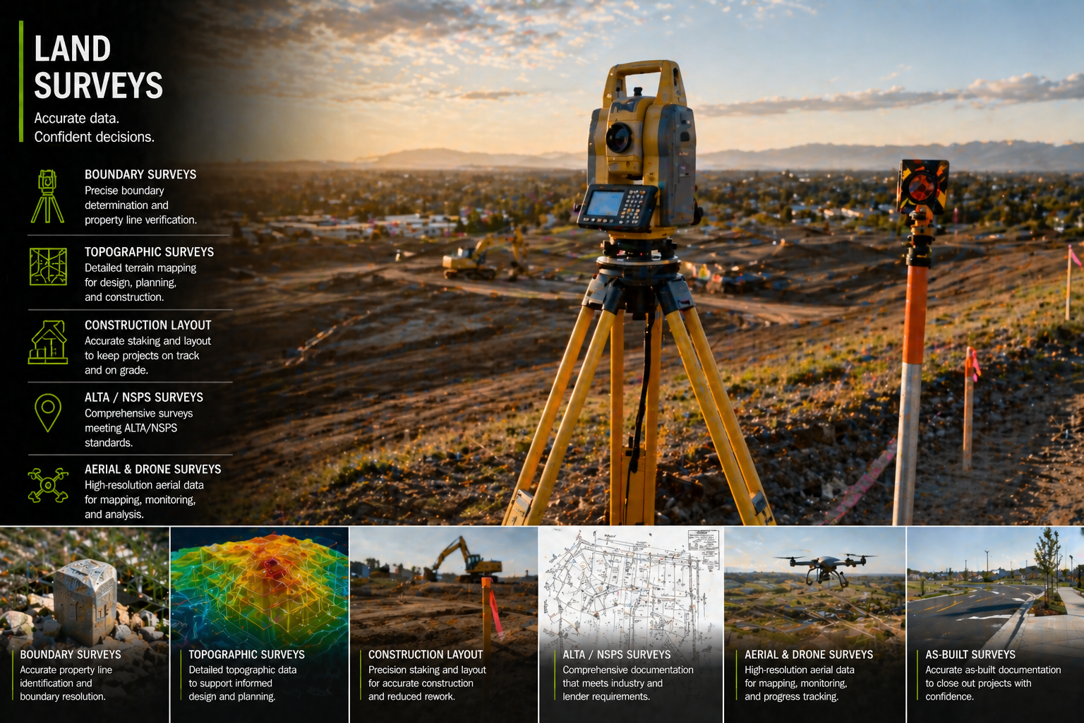
- Real Property Reports (RPRs) in Partnership with MH Surveys: Legal RPR documentation of improvements, easements, right-of-ways, and drainage restrictions, for home buyers, owners, municipalities, lenders, and real-estate professionals.
- Plot plans: Municipal-grade plot plans for property improvement, development-permit applications, and building-department approvals.
- Lot Grading Certificates: Provincial Land Surveyors' Association–compliant lot-grading documentation for new construction, landscaping, and renovation approvals.
- Topographic surveys: 3D topographic base-plan production for engineers, architects, landscape designers, and contractors, with elevation contours, natural and built features, and sub-surface utilities where available.
- Site plans: Survey-based site plans combining legal boundary, existing improvements, and proposed work overlays, suitable for development and building permit applications.
- Subdivision surveys and plan preparation: Tentative and final subdivision plans, survey-based application packages, Land Titles registration support, and presentation and appeals assistance.
- Condominium plans: Strata and bare-land condominium plans for volumetric and horizontal-parcel definition, registered with the applicable provincial Land Titles office.
- Construction stakeouts: Excavation, building-envelope, utility, curb, and grade stakeouts, with the precision the construction schedule requires and the documentation the engineer of record needs to accept.
- Route surveys: Linear-infrastructure surveys for roads, utilities, and trail networks, with stationing, centreline control, and cross-section documentation.
- Grid-line layouts: Building-grid layouts for structural erection, with tolerance analysis and verification reports.
- As-built surveys: Post-construction documentation of building, utility, manhole, valve, hydrant, street-light, and fence locations, delivered as CAD or GIS files suitable for ongoing owner use.
- Pre-construction boundary and encroachment surveys: Site-condition surveys establishing boundary and encroachment status before construction begins, to protect the owner and the contractor against boundary disputes.
- Control-network establishment: Primary and secondary survey control networks for large and multi-phase sites.
- Drone / UAS aerial surveys: Photogrammetry and LiDAR-based aerial data collection for topographic, volumetric, and progress-documentation applications, deployed where they're adequate for the regulatory and engineering decision at hand.
- Volumetric surveys: Stockpile, cut, and fill volume computation for earthworks tracking, quantity verification, and payment-certificate support.
- Legacy record reconciliation: Reconciliation of existing record drawings, historic survey monuments, and registered legal descriptions with current site conditions.
- Coordination with the civil, structural, and land-development teams: Integrated survey planning and data delivery to the in-house engineering teams that will consume the data, so survey scope matches engineering needs.